August often stands for holiday, but not for atmospheric research!
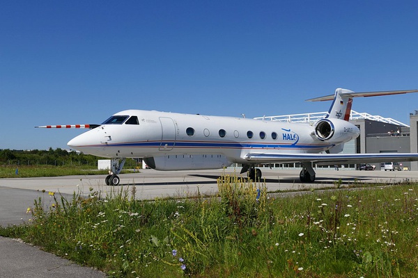
Currently stationed at Barbados, the DLR G550 HALO (High Altitude and Long Range Research Aircraft) has a scientific mission to accomplish: NARVAL-II.
In continuation with NARVAL (“Next Generation Remote Sensing for Validation Studies”), NARVAL-II investigates the role played by convective aggregation in climate through observation of cloud systems in the deep tropics.
Such flight operations require real-time coordination, communication and data transmission from scientific instruments between the scientists on-board and the other players involved.
ATMOSPHERE’s flight mission management platform PLANET supports them in real-time through:
-
Telemetry: transmission of scientific measurements from the aircraft to the ground
-
Collaborative services: multi-channel chat, file transfer, geomarkers
-
Flight following and guidance
-
Weather and aeronautical data integration and display
During this campaign, HALO collects data via multiple scientific instruments such as the Dropsonde system. ATMOSPHERE has developed a new feature enabling the automatic transmission of the generated Dropsonde reports to weather services on the ground.
Interested in learning more about PLANET key features and our experience in special flight operations? Please feel free to write us: contact@atmosphere.aero.
Photo: Minikin, 2016 © DLR


